
Credible Theories Sign in

The record

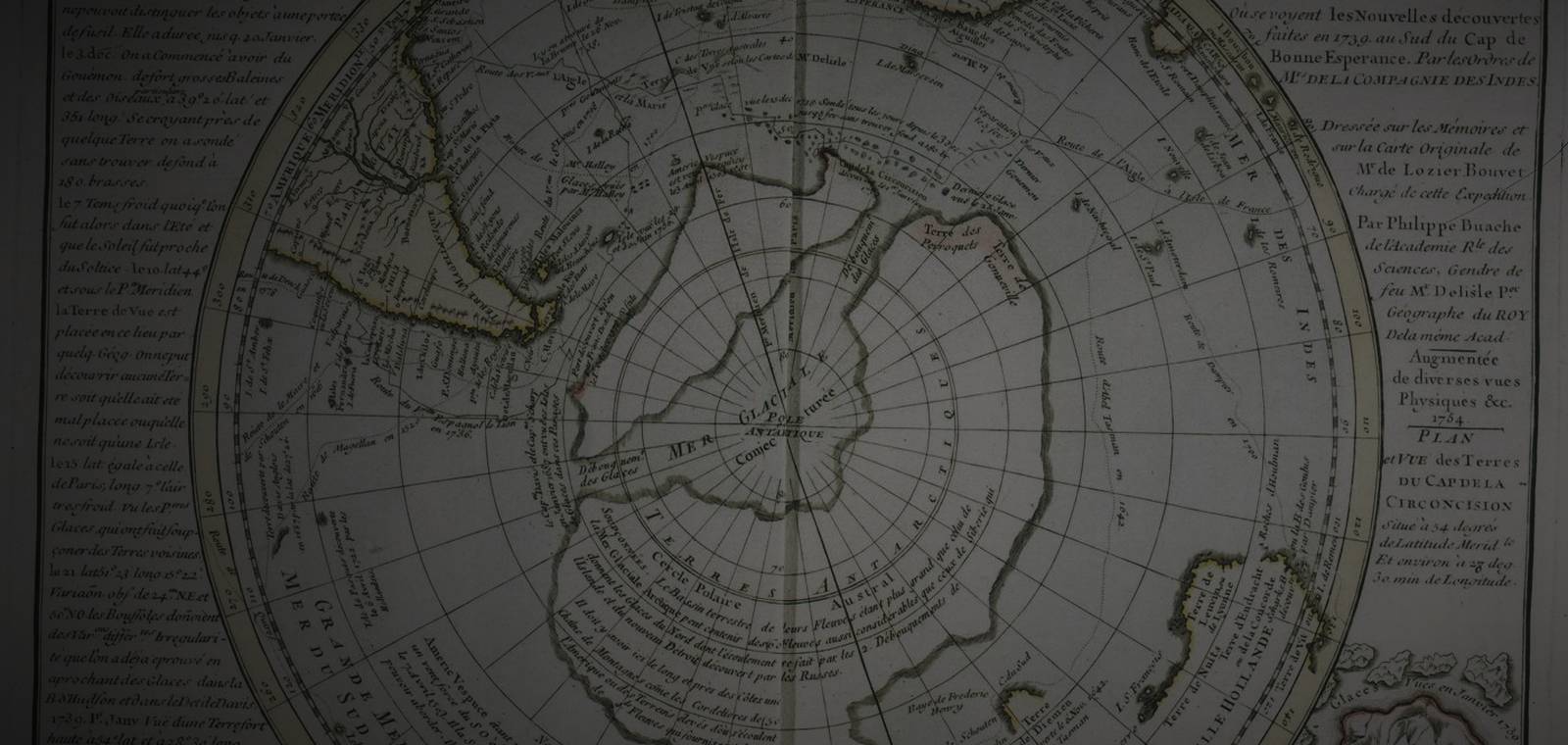
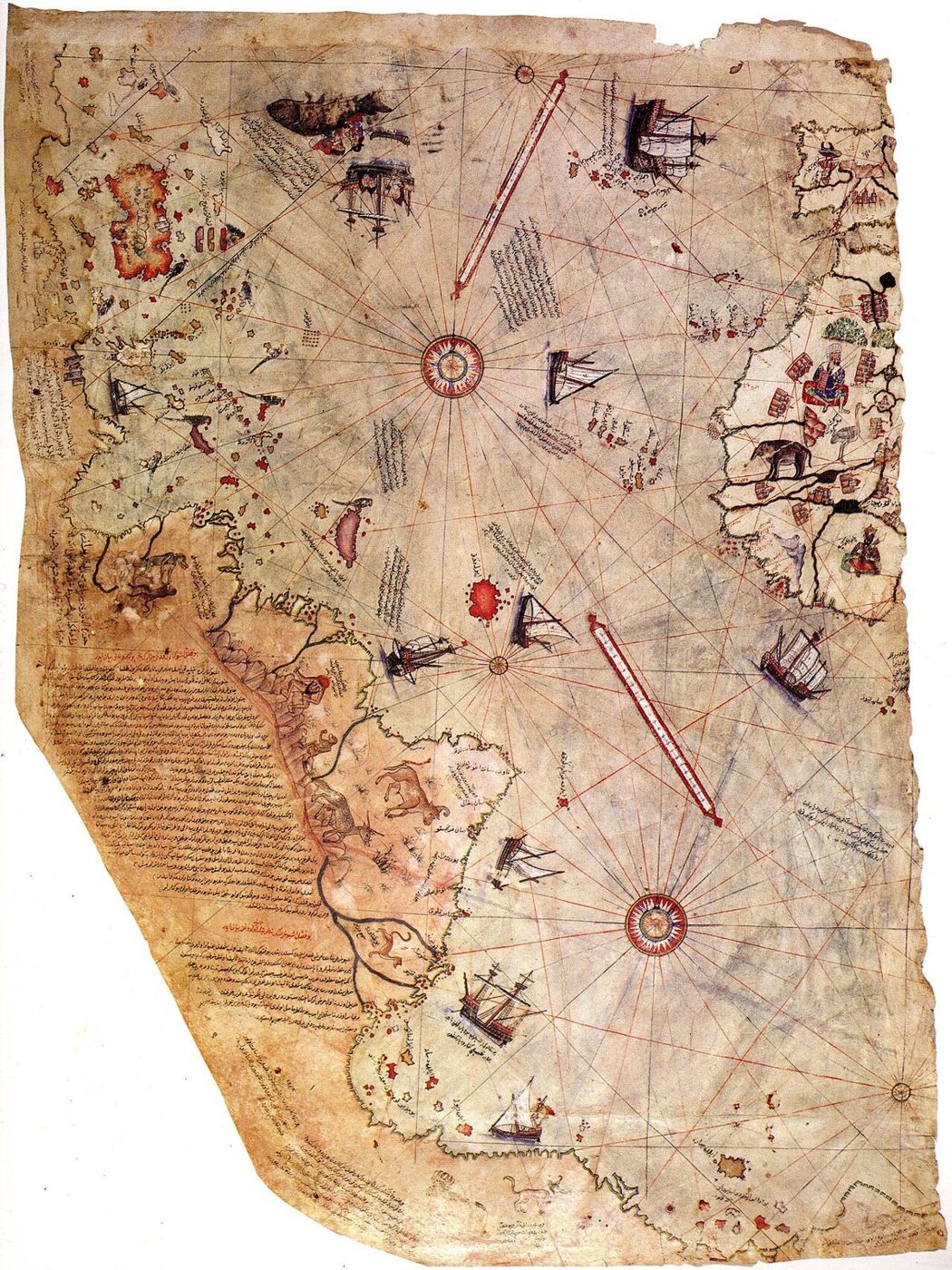
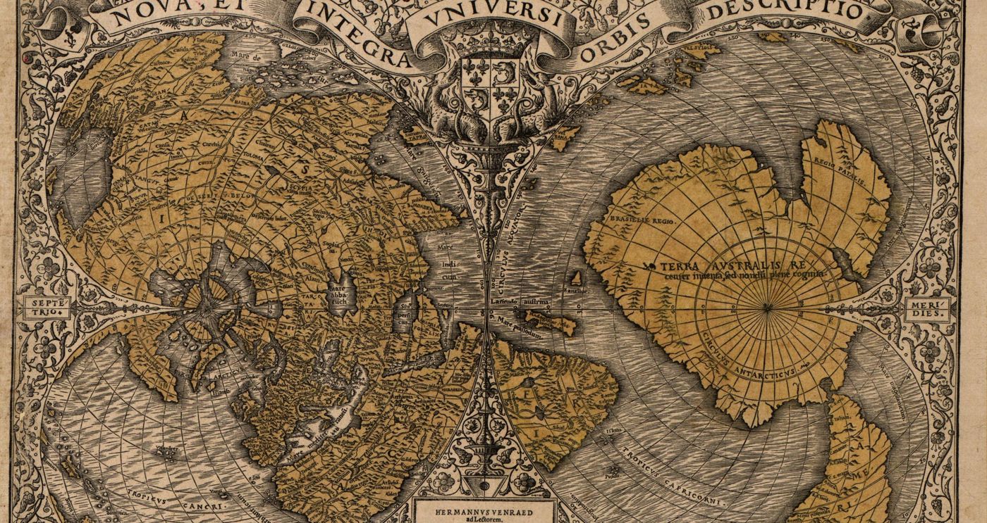
What the maps are. Four maps are named most often. The Piri Reis map, drawn at Gallipoli in 1513, is the surviving piece of an Ottoman world map, and its own note says it was put together From about twenty charts and Mappae Mundi. Oronce Fine's world map of 1531 is, in the Library of Congress's words, the earliest known map on which the name Terra australis appears. Gerard Mercator's world map of 1569, Nova et aucta orbis terrae descriptio, was printed at Duisburg on 18 sheets; the University of Basel copy measures 135 by 212 centimeters. His Atlas was Left unfinished by the author and was edited and published by his son, Rumold Mercator, in 1595. Philippe Buache, who became principal geographer to the French king in 1729, dated his round map of the far south, Carte des terres australes, to 1754. Its title says it was drawn sur les mémoires et sur la carte originale de Mr. de Lozier Bouvet, the leader of a French voyage that sailed south of the Cape of Good Hope in 1739.

What was claimed. In Maps of the Ancient Sea Kings (1966), Charles Hapgood argued that all four carry traces of older charts of Antarctica drawn before its ice. For the Piri Reis map he printed a 1960 letter from a US Air Force squadron commander, Lt. Col. Harold Z. Ohlmeyer, who wrote that the coastline had been mapped before it was covered by the ice cap. Of Mercator, Hapgood wrote: He shows Antarctica on maps he drew himself. One of his maps of the Antarctic appears on Sheet 9 of the 1569 Atlas. He captioned Buache's map Sub-glacial topography of Antarctica, suggested by the 18th century French geographer Buache and said it may show the continent at a time when there was no ice at all. His explanation was the slipping crust he had set out in 1958: Antarctica, he argued, had lately sat farther from the pole, where people of the Ice Age could chart its coast.

What the record shows. Each mapmaker named or showed his sources. Piri Reis listed his charts and called the southern land said to be very hot. The Library of Congress says that Ancient geographers had speculated about the existence of a southern continent, calls Fine's 1534 version a hypothetical continent that geographers posited had to exist to counterbalance the weight of the northern land masses, and notes that The existence of Antarctica was not definitively proven until the 19th century. Buache's map labels the middle of its southern lands Mer Glaciale Conjecturée, French for a conjectured frozen sea, around the South Pole. The Antarctic ice sheet began forming about 34 million years ago.
Questions people ask about Ancient maps of Antarctica

Is there an ancient map of Antarctica?

The maps most often named are the Piri Reis map of 1513, Oronce Fine's world map of 1531, Gerard Mercator's world map of 1569 and Philippe Buache's map of 1754. The Library of Congress says Antarctica's existence "was not definitively proven until the 19th century"; the claim that these maps copy older charts of it comes from Charles Hapgood's 1966 book.

What is the Mercator 1569 map?

It is Gerard Mercator's world map Nova et aucta orbis terrae descriptio ad usum navigantium emendate accomodata, a new and enlarged description of the world adapted for sailors, printed at Duisburg in 1569 on 18 sheets. The University of Basel shows its copy online, and Hapgood pointed to Mercator's maps of the far south as copies of older charts.

What is the Buache map?

Philippe Buache (1700-1773), a French royal geographer and member of the Academy of Sciences, made the Carte des terres australes, a round map of the south from the Tropic of Capricorn to the pole, dated 1754. Its title says it records the discoveries of Bouvet de Lozier's 1739 voyage south of the Cape of Good Hope. The University of Bern shows a copy online.

The open question

Still strange: Four maps of a continent no one had seen.

An Ottoman admiral, a Paris mathematician, Gerard Mercator and a French royal geographer all drew land at the bottom of the world before anyone had seen it, and in 1966 their maps became one case for a lost civilization of the Ice Age.

The Piri Reis Map of 1513 →
  1. Step 1 of 4 · This fileAncient maps of Antarctica
  2. Step 2 of 4 · Next fileThe Piri Reis Map of 1513
  3. Step 3 of 4 · Next fileThe Oronteus Finaeus Map of 1531
  4. Step 4 of 4 · Next fileAntarctica Without Ice: The Real Map and the Old Maps
About these videos

Found by a YouTube search for this topic, not checked by us. The player loads from YouTube only when you press play.

Where this comes from

EvidenceDocumented

Comes from Yusuf Akçura, Piri Reis Haritası / Piri Reis' Map, with English translation of the map's…. Wikisource: A free online library of public-domain texts run by the same foundation as Wikipedia. Volunteers type up old printed works, such as the 1911 Encyclopaedia Britannica, and check them against scans of the pages.

What this means

All four maps are held in libraries and their makers and dates are documented; that they copy older charts of Antarctica without ice is Hapgood's 1966 claim.

For Ancient maps of Antarctica, the original record exists and is linked: Yusuf Akçura, Piri Reis Haritası / Piri Reis' Map, with English translation of the map's…. That tells you the record is real and what it says. It does not mean every claim in it is true.

Primary records exist: an original document, a published text, an official file or a dated report. We link to them. This level says the record exists and what it says, not that every claim in it is true.

See all five labels

Sources

  1. WikisourceA free online library of public-domain texts run by the same foundation as Wikipedia. Volunteers type up old printed works, such as the 1911 Encyclopaedia Britannica, and check them against scans of the pages.Yusuf Akçura, Piri Reis Haritası / Piri Reis' Map, with English translation of the map's marginal notes by Hasan Fehmi Turgal (Turkish Historical Society, Istanbul, 1935)Primary text
  2. Library of CongressThe national library of the United States in Washington, D.C., and one of the largest libraries in the world. Its catalog records describe the real books, maps and papers it holds, with dates, makers and notes by its librarians.Library of Congress, Geography and Map Division, catalog record for Oronce Fine, Noua, et integra uniuersi orbis descriptio ([Paris?], 1531), with the World Digital Library descriptionPrimary text
  3. Library of CongressLibrary of Congress, catalog record for Oronce Fine, Recens et integra orbis descriptio (Paris, 1534), National Library of France copy, with the World Digital Library descriptionPrimary text
  4. e-raraThe shared website where Swiss university and national libraries show scans of their rare books and old maps. Each page is the library's own catalog record for the copy it holds, with the maker, date, size and shelf mark.University of Basel Library, catalog record for Gerhard Mercator, Nova et aucta orbis terrae descriptio ad usum navigantium emendate accomodata (Duisburg, 1569), UBH Kartenslg AA 3-5, on e-raraPrimary text
  5. Library of CongressLibrary of Congress, Rare Book and Special Collections, catalog record for Gerhard Mercator, Atlas sive Cosmographicae meditationes de fabrica mundi (Duisburg, 1595), Lessing J. Rosenwald CollectionPrimary text
  6. e-raraUniversity of Bern Library, catalog record for Philippe Buache, Carte des terres australes, comprises entre le tropique du Capricorne et le pôle antarctique (Paris, 1754), Ryhiner collection, MUE Ryh 1106 : 55, on e-raraPrimary text
  7. Library of CongressLibrary of Congress, catalog record for Philippe Buache, Physical Map of the Indian Ocean (1757), with the World Digital Library description of Buache's life and workPrimary text
  8. Internet ArchiveA nonprofit digital library in San Francisco, founded in 1996, that holds millions of scanned books, papers and recordings. A scan there shows the pages of a real printed book or document.Charles H. Hapgood, Maps of the Ancient Sea Kings: Evidence of Advanced Civilization in the Ice Age (Chilton Books, Philadelphia, 1966), with the 6 July 1960 letter from Lt. Col. Harold Z. OhlmeyerPrimary text
  9. AramcoWorld archiveThe online archive of AramcoWorld (earlier Aramco World), a magazine about the history and cultures of the Arab and Muslim worlds, published by the Aramco oil company since 1949. Its articles are written by named journalists and historians.Paul F. Hoye and Paul Lunde, "Piri Reis and the Hapgood Hypotheses", Aramco World 31, no. 1 (January/February 1980)
  10. A research articleAn article written by a researcher and published in a scholarly journal or book. Most such journals have other experts check a paper before it is printed, so it carries more weight than a news story, though later studies can still change the picture.Heidelberg University, "New Insights Into the Formation of the Antarctic Ice Sheet" (5 August 2024), on Klages and others, Science 385, no. 6706 (2024), pp. 322-327Primary text

Quotations come from public-domain translations. A book in our Library links to its Library page; other links open the free online copy or the reference page.

Updated

Credible or not?

Tap one to see how other readers voted.

Discussion