

What is The Nazca desert known for?
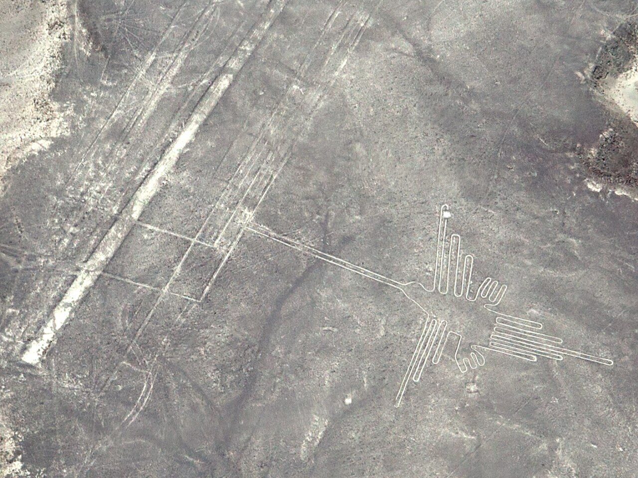
The plains around Nazca and Palpa in southern Peru hold the Nazca lines, one of the largest groups of ground drawings in the world. UNESCO lists them as a World Heritage site and says the figures and lines were scratched on the surface of the ground between 500 BCE and 500 CE, across about 450 square kilometers.
The drawings include animals, plants and imaginary beings, as well as straight lines and geometric shapes several kilometers long. UNESCO dates foreign scientific study and conservation work in the area from 1941.
In 2024 a team from Yamagata University and IBM Research reported finding 303 new figures with help from an AI model, after six months of checks on the ground. That brought the known figures from 430 to about 733. The team found that smaller figures cluster beside old footpaths, which suggests people walking the desert were meant to see them.
Linked people and places
Where this comes from
Comes from Masato Sakai and others, "AI-accelerated Nazca survey nearly doubles the number of known…. A research article: An article written by a researcher and published in a scholarly journal or book. Most such journals have other experts check a paper before it is printed, so it carries more weight than a news story, though later studies can still change the picture.
What this means
A real place with records. Sources are listed below.
For The Nazca desert, the original record exists and is linked: Masato Sakai and others, "AI-accelerated Nazca survey nearly doubles the number of known…. That tells you the record is real and what it says. It does not mean every claim in it is true.
Primary records exist: an original document, a published text, an official file or a dated report. We link to them. This level says the record exists and what it says, not that every claim in it is true.
Sources
- UNESCO World Heritage CentreThe official website of the World Heritage list kept by UNESCO, the United Nations agency for education, science and culture. Each place's page gives an expert-checked description of the site and why it matters.UNESCO World Heritage Centre, "Lines and Geoglyphs of Nasca and Palpa" (site 700)
- A research articleAn article written by a researcher and published in a scholarly journal or book. Most such journals have other experts check a paper before it is printed, so it carries more weight than a news story, though later studies can still change the picture.Masato Sakai and others, "AI-accelerated Nazca survey nearly doubles the number of known figurative geoglyphs and sheds light on their purpose", PNAS (September 2024), doi 10.1073/pnas.2407652121, as announced by Yamagata UniversityPrimary text
No public-domain picture of this place yet. We do not show drawn or generated likenesses.